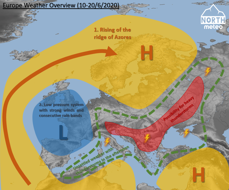
The weather seems to remain unsettled for the most of Europe the next ten days of June. Watch how this unsettled weather will be distributed over our continent.
Please support us by following us on facebook, youtube and instagram.
In particular, for the period 10-20/6/2020:
1. The rise of the Azores anticyclone with a final destination over Anticyclone is expected to cause the formation of a new low pressure system over the northwest of Europe. This weather system will be followed by consecutive rain bands and zones of strong winds at times and places in the UK and France, while the temperature will remain around or below the average. In contrast, Scandinavia will face fairly warm and dry conditions with temperature much above the average.
2. At the same time, colder air masses will slide to the southwest from Russia affecting the Balkans, Switzerland, Italy, and Iberia with convective weather mostly in the afternoon. The temperature in all these regions will be fluctuating around the average.
3. No heat wave is expected this period over Europe. The only exception is some possibility for short periods of occasionally warm weather in Iberia.
4. From the regions mentioned in 2, the Balkans (till northern Greece, the southern of Germany and Switzerland appear to be highly likely to be affected by heavy thunderstorms at times.
The current article is just an estimation of the possible average situation over Europe the period 10-20/6/2020 over Europe.