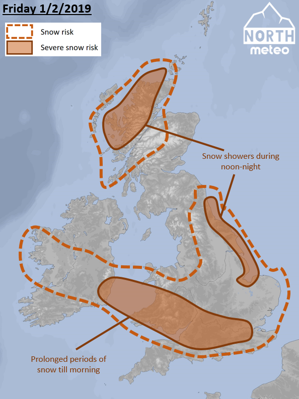
Snowfalls have already visited (31/1/2019) southern regions of the UK. However, snow is expected to fall mostly in southern and eastern regions during the next hours. Let’s have a comprehensive look.
In early morning, snowfalls are expected mainly in central Ireland, Wales, Midlands and south-southeast regions, which may be heavy at times in south Wales and southern UK. However, during the morning (towards to noon) the stream will turn into east, which means that snowfalls will get lighter and gradually stop in these places, while east coast and northern Scotland will be affected by snow showers (heavy at times). Such situation will be preserved until the end of the day.
WINDS: North-easterlies will be strong (until 50-70km/h) in the southwest regions and northwest Scotland.
TEMPERATURES: Around -6°C to -8°C early in the morning in Scottish Highlands, around -1°C to 2°C in the South. Temperatures will raise to 0-2°C in Scotland and 3-5°C in south-southeast.
Please send us your snow video to our email (s.keppas@northmeteo.gr) via WETRANSFER and we will publish it on youtube or on the website.
You can monitor the current temperature observations in the UK through our live maps HERE.
You can stay informed about the weather following our facebook group and youtube channel.