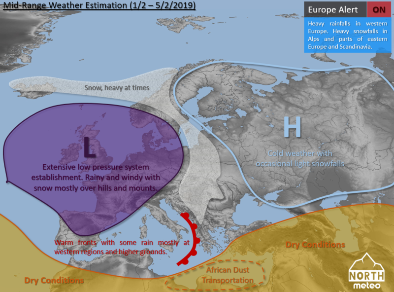
The weather continues during the first five days of February (2019) to present an unsettled character almost for the majority of the European continent. However, the major part of precipitation will be occurring in the western countries.
The weather will still present an interesting pattern in western Europe, where a new extensive low pressure system will affect mainly the UK, France, Italy, parts of Iberia and their neighbouring countries with rain and strong winds at times and places. Snow will occur over hills and mounts with a small possibility for occasional snow at lower grounds. This situation will probably extend over northwestern Africa. Severe snowfalls are expected in the Alps, but also in regions of eastern Europe, northwestern Balkans and parts of Scandinavia. In the very eastern/northeastern regions, the weather will remain cold and dry with just a few occasional episodes of (light) snow.
In the central-eastern Mediterranean, the weather will remain unsettled and wet due to the passage of one (or more) warm front(s), with rainfalls, which will be heavier and more frequent in western coasts and mounts of such regions. Snow may occur over mounts. African dust transportation is expected south of Greece and Turkey, while in Turkey and further east the weather will be drier.
You can stay informed about the weather following our facebook group and youtube channel.
